Temples
Prasat Phnom Cheung Prei
Overview
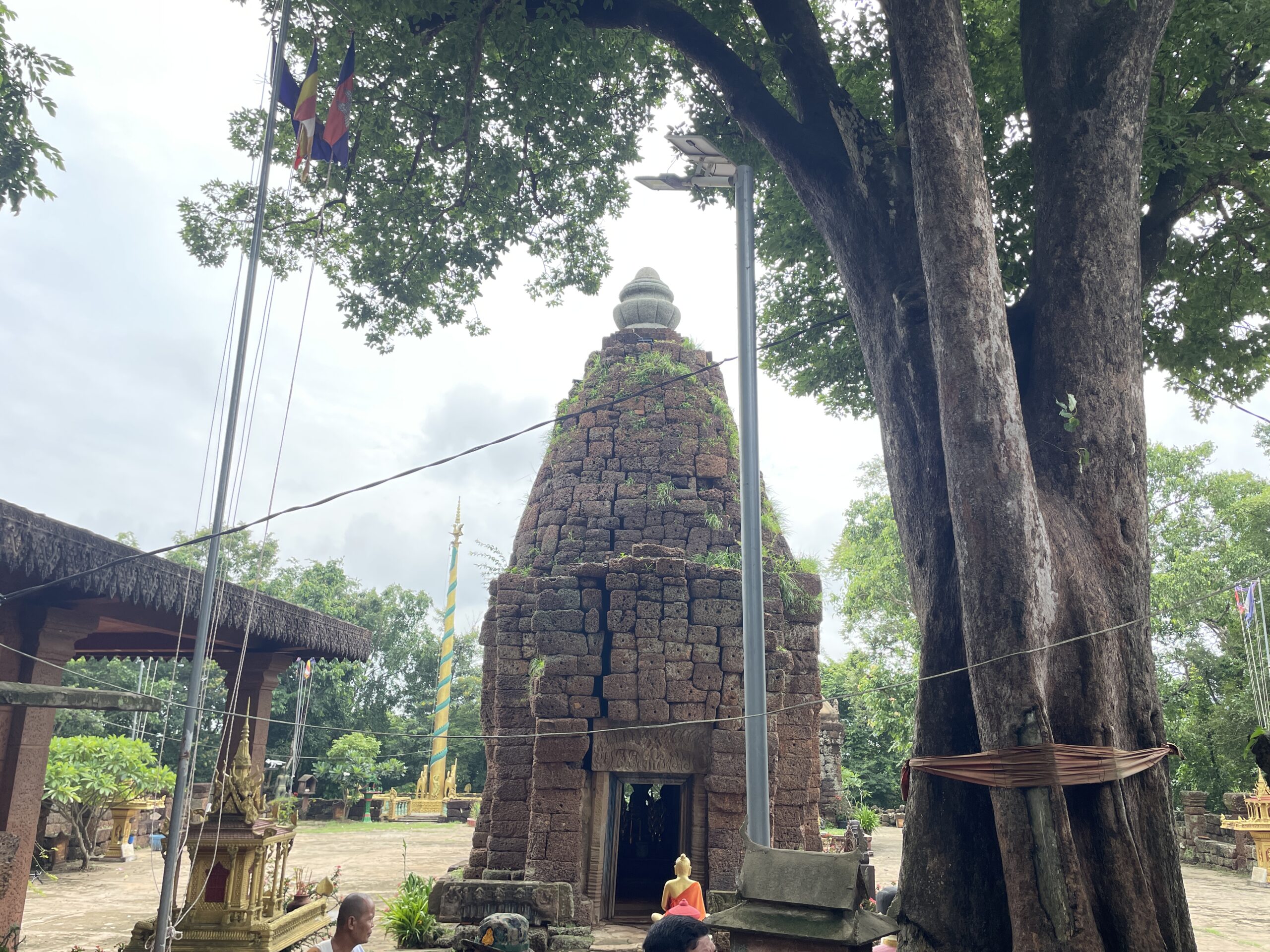
Prasat Phnom Cheung Prei: A Multi-Layered Sanctuary in Kampong Cham Perched atop a isolated hill in central Cambodia, Prasat Phnom Cheung Prei offers a compelling window into the architectural evolution of the Khmer Empire, preserving traces that bridge the early pre-Angkorian era with the height of the Angkorian period. Location & Topography The temple site is located in Kouk Rovieng village, Kouk Rovieng commune, within the Cheung Prey district of Kampong Cham province. Situated north of National Road 6—approximately 3 km east of the Phaav market—the site is reached via a 1,500-meter track heading north. The immediate landscape consists of two distinct hills set about 100 meters apart: Phnom Srei ("Female Hill") / Phnom Thom: The higher eastern hill, which holds the ancient sanctuary. French archaeologist Lunet de Lajonquière originally documented the temple under the name Phnom Thom, a moniker that has since been supplanted by the district's name. Phnom Pros ("Male Hill") / Phnom Preah Bat: The lower western hill. Archaeological & Construction Phases Physical evidence on the hilltop points to at least two distinct periods of major construction, with an intriguing intermediary period. Phase I: Pre-Angkorian Foundation (1st Half of the 7th Century) The earliest sacred activity on the hill dates to the Zhenla period under the Sambor Prei Kuk style.
Video
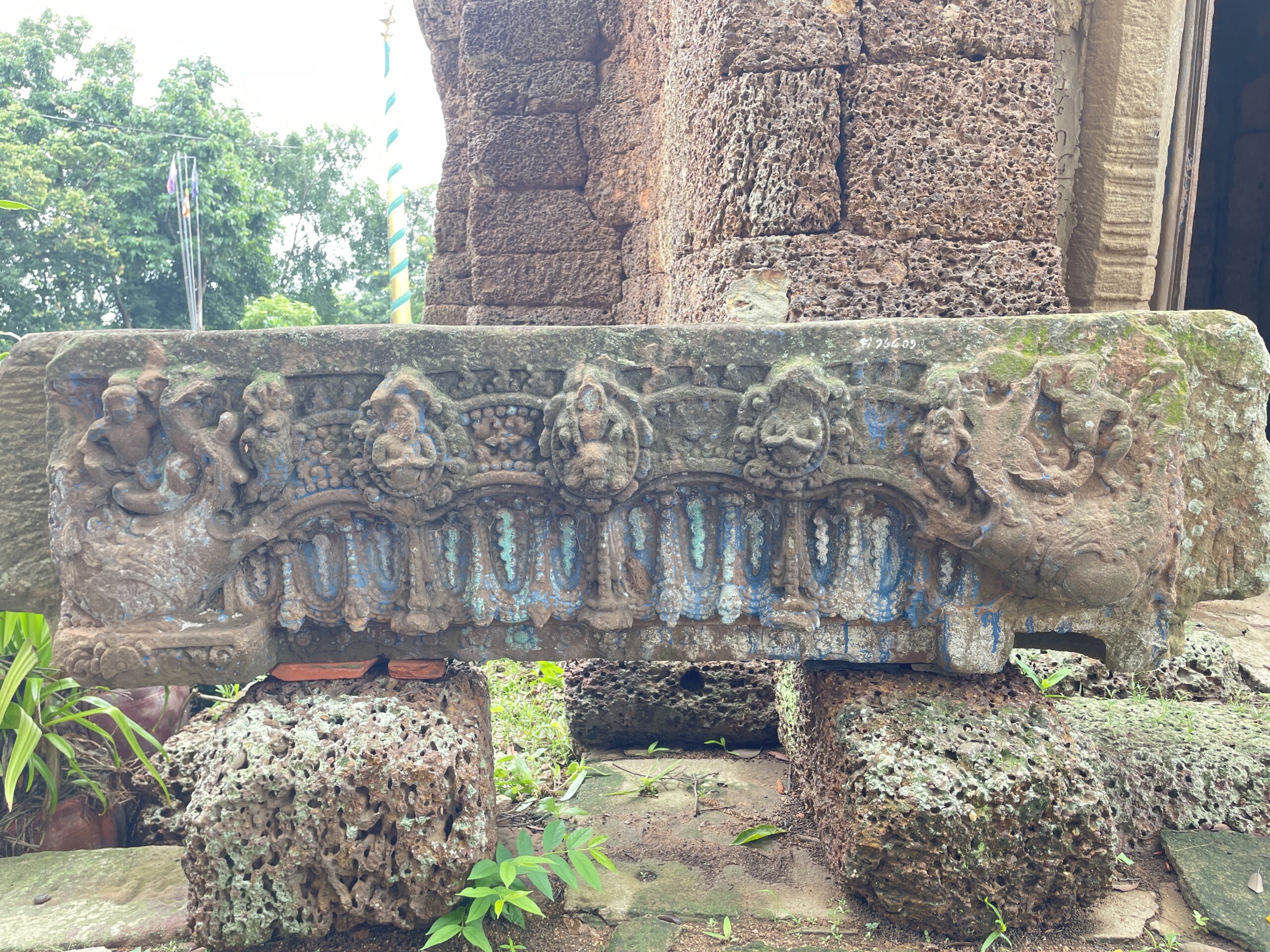
Because pre-Angkorian sanctuaries were traditionally built of brick, the original 7th-century structure no longer stands; however, two fine sandstone lintels survive on-site as diagnostic evidence: Inward-Facing Makaras: Both lintels feature mythic aquatic creatures at their outer edges facing inward, each bearing a small rider. Sagging Arch & Medallions: A lowered arch spans between the makaras, holding round medallions with carved figures, framed by regular festoons, garlands, and dangling pendants underneath. Iconography: One lintel (located inside the sanctuary) depicts a clear bull's head inside a medallion—most likely Nandin, the vehicle of Śiva. This suggests the original pre-Angkorian site was a Śaiva hilltop sanctuary. The second lintel (located outside) features seated figures and a central rider on an eroded mount. Phase II: The Intermediary Period (8th–10th Centuries) No standing structures or securely dated artifacts can be definitively assigned to these intermediate centuries. However, the presence of various uncatalogued lintel fragments and decorated pedestals hints that the site remained active. A complete systematic survey of all loose site stones is necessary to fully document this era. Phase III: Angkorian Reconstruction (11th–12th Centuries) The standing visible architecture on Phnom Srei reflects a major rebuilding project during the classical Angkorian period: Sanctuary Layout: The main tower is a square laterite sanctuary featuring a single interior chamber with active doorways on both the east and west (omitting the usual false doors). The eastern doorway was originally preceded by a brick forebody with pillars, flanked by turned-baluster stone windows. A secondary, small square laterite chamber sits just to the south, opening to the east. Enclosure: The layout featured an outer enclosure wall supported by northern and southern peristyle galleries and a western chambered entrance gopura. Style & Dating: The central lintel depicts a prominent central Kāla (monster mask) crowned by a deity, with foliage branches forming wide downward loops. The absence of makaras and medallions places this carving squarely in the Baphuon to Angkor Wat styles (mid-11th to mid-12th century). Lifting Holes: Many laterite blocks exhibit round transport holes—a quarrying technique heavily associated with large-scale late 12th-century construction (Jayavarman VII era)—suggesting continued building or repair work into the early 13th century.
See more attractions
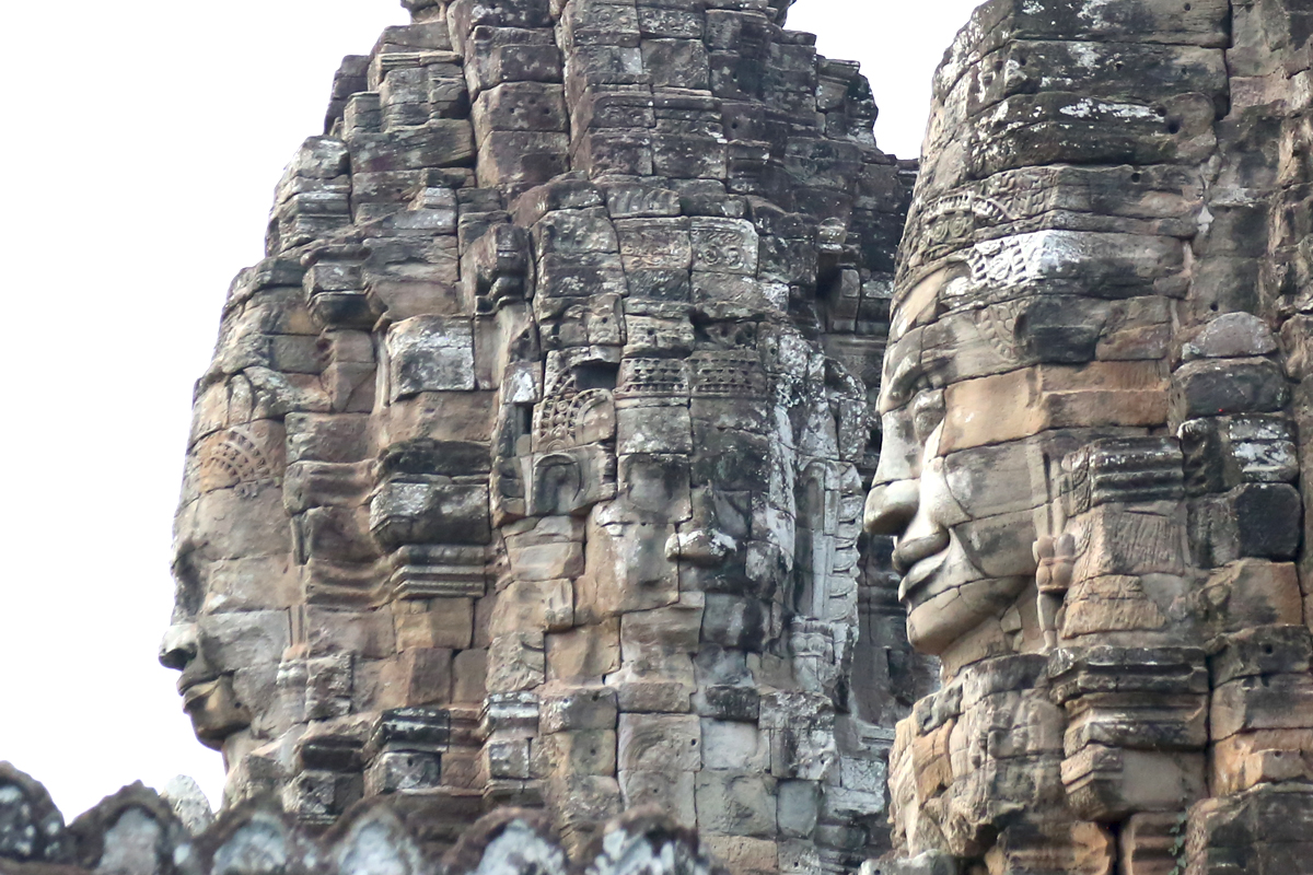
Bayon faces
The monumental face towers of Bayon Temple stand as the primary icon of late 12th-century Khmer art and state theology. Built during the reign of King Jayavarman VII, these giant stone faces synthesize royal authority, esoteric Tantric protection, and Pure Land Buddhist cosmology into a single architectural monument.
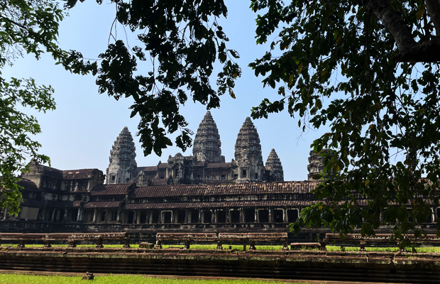
Angkor Wat
Angkor wat is one of 40 principal temples in Angkor archeological park. It becomes the national emblem of Cambodia as shown in the middle part of Cambodian national flag. Constructed from 1113 AD until 1150 AD on 163 hectares, Angkor Wat is the biggest religious edifice in the world. Not only its amazing dimension, this Hindu god’s residence stores plenty of ancient information through the style of architecture, the iconography and the inscription as well. Since it’s under the Hindu influence, Angkor Wat, built during the king Suryavarman II, inspired the doctrines of the Hindu cosmology, its astrology and so exalted by the mythology. Each measure of length and width follows the duration of Yuga or Mahayuga. For example, the distance of causeway crossing the moat at the west entrance measures 432 cubits (Hath or Arm) which relates to 432 000 years of Kaliyuga.
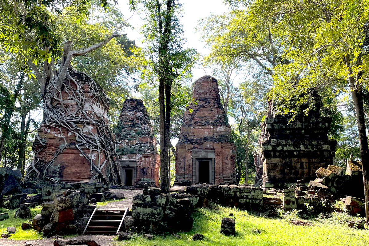
Prasat Pram
Prasat Pram is one of the hundreds of religious shrines at the Koh Ker site, which extends over 81 square kilometers. This brick structure, consisting of five edifices, was built in the mid-tenth century by King Jayavarman IV and is dedicated to Lord Vishnu. Its location is situated to the south of Prasat Thom, the main temple with a pyramid shape in the center of Lingapura, the city of Shivalinga. Prasat Pram served as a satellite temple, similar to other temples like Prasat Linga in Koh Ker.
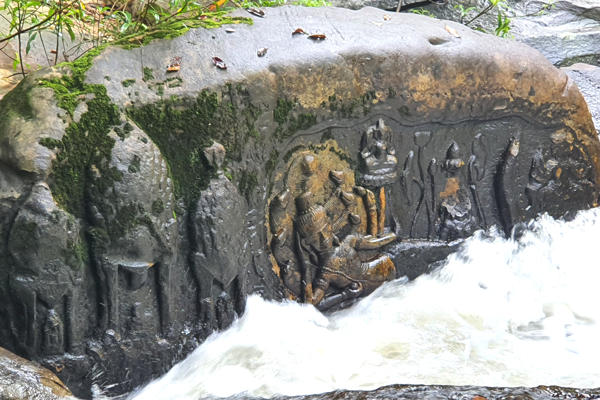
Kbal Spean
Kbal Spean is an open-air riverbed sanctuary where intricate reliefs were carved directly into the natural sandstone bedrock and boulders of the Stung Kbal Spean River. The carving of the site began during the reign of King Suryavarman I in the 11th century and was completed under King Udayadityavarman II. The riverbed and banks feature hundreds of carved lingas (phallic representations of Shiva) arranged in grid patterns beneath the flowing water, along with depictions of yonis (the sacred feminine symbol). Reliefs depict Lord Shiva seated on his sacred bull, Nandi, alongside his consort Parvati. Reaching the carved riverbed requires an uphill hike through thick tropical jungle along a 1.5-kilometer forested trail. The name Kbal Spean translates to "Head of the Bridge," referring to a naturally formed sandstone rock arch span over the river. Nearby, a small seasonal waterfall flows over the carved stone during and immediately following the rainy season.